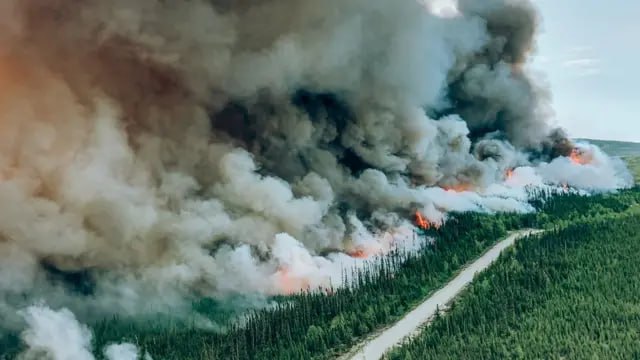
A comprehensive study of a large-scale forest fire in the province of
Quebec, Canada. The analysis includes determining the area of burned
areas, monitoring the spread of fire, heat mapping of active fire
centers, and assessing the long-term consequences for forest
ecosystems.
In case of fires, SAR images respond to changes in surface and
vegetation. If the territory is engulfed in fire, the following
appears on the images: Before it gets too hot: forests, fields and
trees will look remarkably bright (the trees are very good at picking
up the radar signal). Before and after burning: the burnt surface
becomes smoother and is covered with a charcoal-black mass or ash.
Such a surface may not transmit the radar signal back to the
satellite, so the area on the SAR image appears dark.
Satellite image analysis
In winter, SAR images of forests are mostly gray or dark, although
they can appear lighter if the snow cover is uneven. During this
period, trees have no leaves, so the signal reflection is lower. If
there is snow on the branches, the signal is partially scattered,
giving the image a light-gray tone. In spring, the images become
brighter and more textured. This is due to the appearance of leaves
and increased soil moisture, which enhances the scattering of radio
waves. In summer, the forest appears medium-bright or bright and has
a pronounced texture. Tree canopies are dense and contain a lot of
moisture, so the forest strongly reflects the radar signal. The
image often looks heterogeneous and “fluffy.” In autumn, the images
gradually darken. Leaves fall, reducing signal reflection. However,
after rains, bright areas may appear due to increased soil moisture.
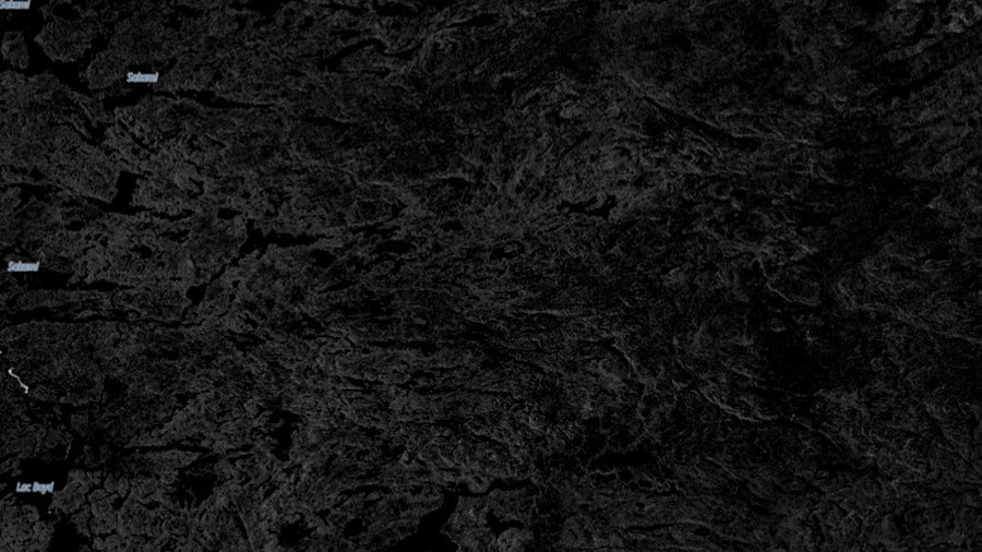
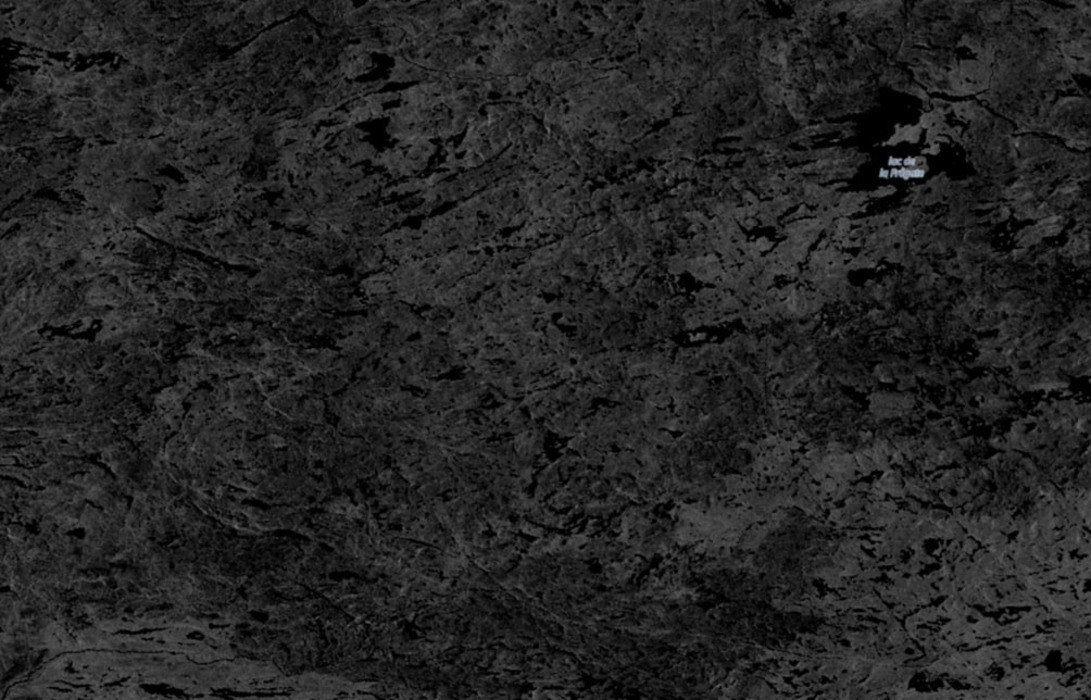
Before/After the Disaster Comparison
Before
After
Before: the forest appears heterogeneous and has a medium or bright
tone. This indicates dense tree canopies and high moisture content,
which strongly reflect the radar signal. In addition, dark areas are
visible, which are likely lakes or rivers, as water usually does not
reflect the signal back to the satellite. In the After image, the
scene has become noticeably darker and less textured, especially in
the central area. This is the main change. Burned trees and fallen
leaves reduce the reflection of the radar signal, making the terrain
appear darker.
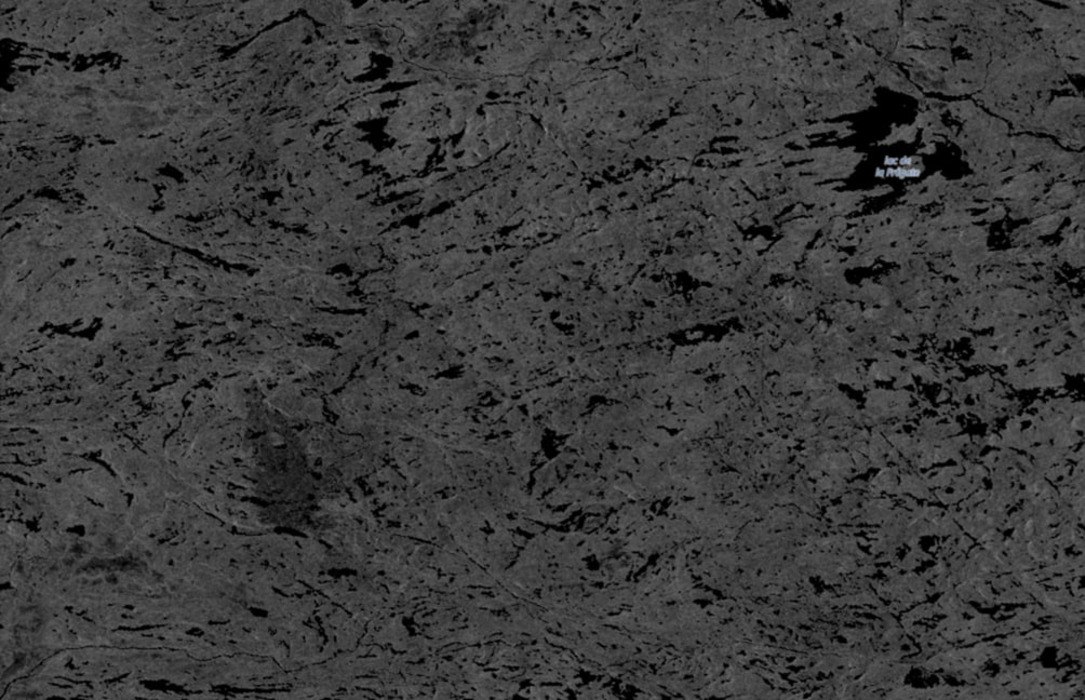
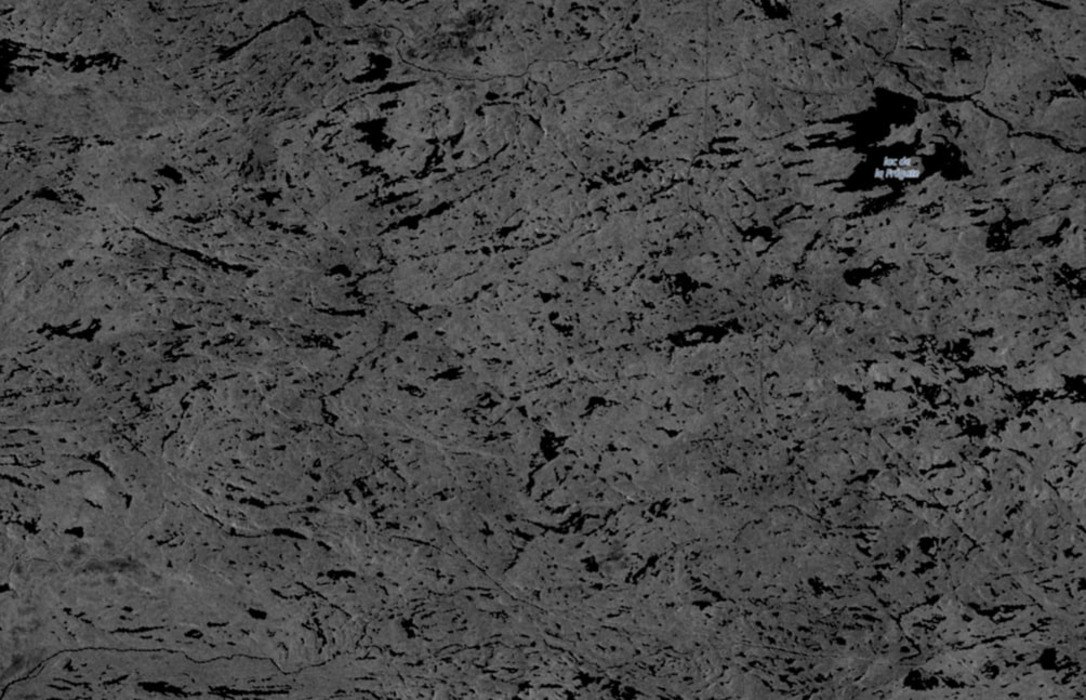
Now
The surface appears mostly dark and uneven, with irregular dark
patches indicating burned areas that reflect the radar signal weakly.
Brighter spots suggest zones of moisture or partial vegetation
recovery. The texture remains heterogeneous, showing clear traces of
fire impact even two years later.